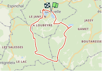
![](/images/other/stat-length.png)
![Trail Walking La Godivelle - La Godivelle - Mt Chamaroux - la Godivelle - Photo](https://media.geolcdn.com/t/1900/400/441f9256-fb8a-465f-b457-c6ff2b09e578.jpg&format=pjpeg&maxdim=2)
La Godivelle - Mt Chamaroux - la Godivelle
meunier.ph.
User
![Length](/images/other/stat-length.png)
![Max alt](https://static1.geolcdn.com/siteimages/upload/files/1508320355ic_sort_altitude_max_24dp.png)
![Uphill gradient](https://static1.geolcdn.com/siteimages/upload/files/1508320355ic_sort_den_pos_24dp.png)
![Km-Effort](/images/other/stat-length.png)
![Min alt](https://static1.geolcdn.com/siteimages/upload/files/1508320355ic_sort_altitude_min_24dp.png)
![Downhill gradient](https://static1.geolcdn.com/siteimages/upload/files/1508320355ic_sort_den_neg_24dp.png)
![Boucle](https://static1.geolcdn.com/siteimages/upload/files/16400158638029165_repeat_loop_refresh_sync_direction_icon.png)
![Walking](https://static1.geolcdn.com/sitytour/trail-icons/101.png)
4h30
Difficulty : Medium
![Scan this QR Code to open this trail in the SityTrail application](https://capi.geolives.com/qq0zvz2zws4bq2lad0pu/sitytour/trails/2847119/qr.png?size=200)
FREE GPS app for hiking
About
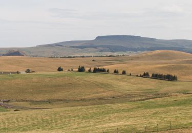
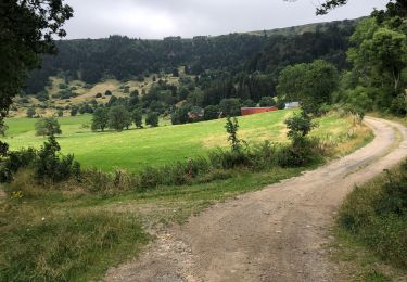
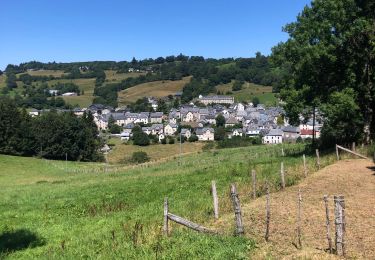
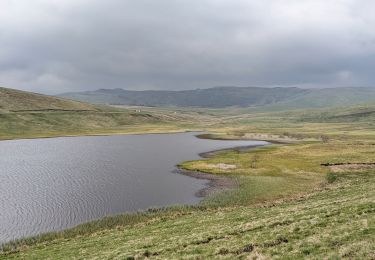
Trail Walking of 16.8 km to be discovered at Auvergne-Rhône-Alpes, Puy-de-Dôme, La Godivelle. This trail is proposed by meunier.ph..
Description
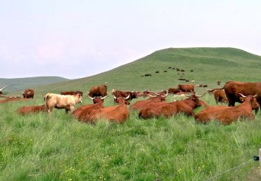
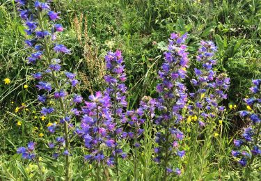
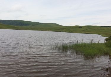
Traversé non prévue dans une tourbière. Cheminement hors sentiers dans les estives, quelquefois parmis les troupeaux de vaches. Calme absolu dans cette " petite Mongolie " pleine de charme et de grands espaces.
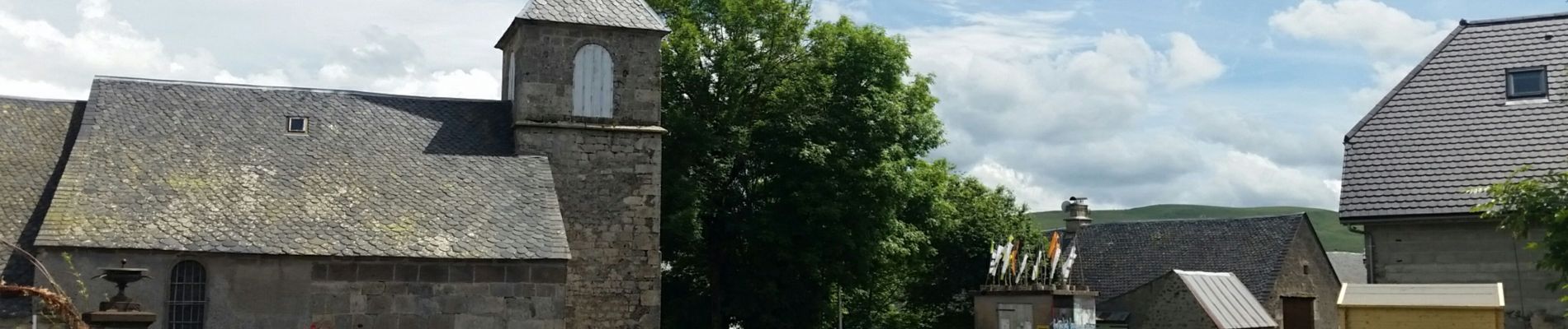
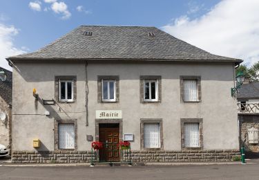
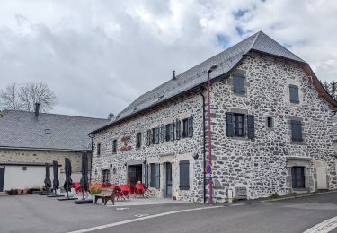
Maison du randonneur à la Godivelle pour faire étape et dîner.
Positioning
Comments
Trails nearby
![Walking Walking](https://static1.geolcdn.com/sitytour/trail-icons/101.png)
Walking
![](/images/other/stat-length.png)
![](https://static1.geolcdn.com/siteimages/upload/files/16400158638029165_repeat_loop_refresh_sync_direction_icon.png)
![Trail On foot Espinchal - Le Bois de Play - Photo](https://media.geolcdn.com/t/375/260/9599b8e6-5ea9-47d4-b175-142e2bc24cd5.jpeg&format=jpg&maxdim=2)
![On foot On foot](https://static1.geolcdn.com/sitytour/trail-icons/100.png)
On foot
![](/images/other/stat-length.png)
![](https://static1.geolcdn.com/siteimages/upload/files/16400158638029165_repeat_loop_refresh_sync_direction_icon.png)
![Trail On foot Saint-Alyre-ès-Montagne - Jassy - Photo](https://media.geolcdn.com/t/375/260/f6a39d7f-3eb2-4bee-b23e-c7306ca9ede6.jpeg&format=jpg&maxdim=2)
![On foot On foot](https://static1.geolcdn.com/sitytour/trail-icons/100.png)
On foot
![](/images/other/stat-length.png)
![](https://static1.geolcdn.com/siteimages/upload/files/16400158638029165_repeat_loop_refresh_sync_direction_icon.png)
![Trail Walking Compains - Brion-Anzat le Luguet TVR - Photo](https://media.geolcdn.com/t/375/260/12ace1df-d788-43c7-b056-92d1d1825139.jpg&format=jpg&maxdim=2)
![Walking Walking](https://static1.geolcdn.com/sitytour/trail-icons/101.png)
Walking
![](/images/other/stat-length.png)
![](https://static1.geolcdn.com/siteimages/upload/files/16400158638029165_repeat_loop_refresh_sync_direction_icon.png)
![Trail Walking Montgreleix - Mongreleix Egliseneuve d’Entraigues - Photo](https://media.geolcdn.com/t/375/260/a9310c67-a457-42c4-8401-15775872d177.jpg&format=jpg&maxdim=2)
![Walking Walking](https://static1.geolcdn.com/sitytour/trail-icons/101.png)
Walking
![](/images/other/stat-length.png)
![](https://static1.geolcdn.com/siteimages/upload/files/16400158638029165_repeat_loop_refresh_sync_direction_icon.png)
![Trail Walking La Godivelle - boucle la godivelle jassy 15km - Photo](https://media.geolcdn.com/t/375/260/cf691889-7eab-458e-8f1a-dea426450050.jpg&format=jpg&maxdim=2)
![Walking Walking](https://static1.geolcdn.com/sitytour/trail-icons/101.png)
Walking
![](/images/other/stat-length.png)
![](https://static1.geolcdn.com/siteimages/upload/files/16400158638029165_repeat_loop_refresh_sync_direction_icon.png)
![Trail Walking Montgreleix - boucle de 9 km autour de montgreleix - Photo](https://media.geolcdn.com/t/375/260/884ede25-6646-4e46-8171-3c8e55a2564c.jpg&format=jpg&maxdim=2)
![Walking Walking](https://static1.geolcdn.com/sitytour/trail-icons/101.png)
Walking
![](/images/other/stat-length.png)
![](https://static1.geolcdn.com/siteimages/upload/files/16400158638029165_repeat_loop_refresh_sync_direction_icon.png)
![Trail Walking Saint-Alyre-ès-Montagne - Boutaresse - Photo](https://media.geolcdn.com/t/375/260/9c83b3e6-2b91-4e87-9383-583525eecb5e.jpg&format=jpg&maxdim=2)
![Walking Walking](https://static1.geolcdn.com/sitytour/trail-icons/101.png)
Walking
![](/images/other/stat-length.png)
![](https://static1.geolcdn.com/siteimages/upload/files/16400158638029165_repeat_loop_refresh_sync_direction_icon.png)
![Trail Walking Saint-Alyre-ès-Montagne - Jassy brion La Godivelle - Photo](https://media.geolcdn.com/t/375/260/7be303b1-1301-4f3e-a14f-a24f9414e5ff.jpg&format=jpg&maxdim=2)
![Walking Walking](https://static1.geolcdn.com/sitytour/trail-icons/101.png)
Walking
![](/images/other/stat-length.png)
![](https://static1.geolcdn.com/siteimages/upload/files/16400158638029165_repeat_loop_refresh_sync_direction_icon.png)